
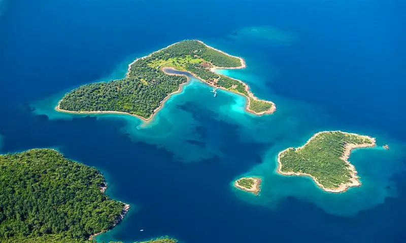
トルコのムグラ
ムグラは、時の流れが止まったかのような場所として知られており、歴史と自然がそのまま残され、エーゲ海と地中海の間に位置する細長い地峡に、海と松の森が、まるでサンゴ礁のように絡み合っている。
エーゲ海地方の南部に位置するムグラは、美しい景観、温暖な気候、そして手つかずの自然が残るビーチに恵まれ、人気の観光地となっている。古代から現代に至るまで、この街の豊かな歴史と文化は受け継がれてきた。
洞窟に残る壁画によると、長い歴史の中で多くの文明が栄えたムグラ地域における最初の人間居住の痕跡は、先史時代にまで遡る。
ムグラで太陽、砂浜、海を楽しみながら、観光客は、街にある多くの博物館や考古学的な遺跡を訪れることで、この地域の豊かな歴史についても学ぶことができます。
ムグラにある文化センター
人気の観光スポットであるムグラ文化会館(ムグラ・クルトゥル・エヴィ)は、伝統的なトルコ建築の素晴らしい例です。1800年代に建てられ、1999年に国有化されたこの文化会館では、トルコとギリシャの建築様式を並べて鑑賞することができます。
ムグラ博物館
Our museum features Archeology, Ethnography, Gladiator, and Natural History Halls spread out over two stories and arranged around an open courtyard. Items such as weaving looms and tool chests can be found in the ethnography section of the museum. The Stratonikeia ancient city donated seven gladiator grave steles to the Gladiators Hall, and the Archaeology Department displays fossils of plants and animals that are 9 million years old.
ヤグジュラー イン
1940年代から、多くの旅行者がヤグジュラー・ハン(Yagcilar Hani)に宿泊するようになりました。この街が最盛期を迎えた頃、ヤグジュラー・ハンは重要な商業拠点として機能していました。この宿の庭にはプラタナスが植えられており、日陰を作ってくれます。かつては古い油工場(またはヤグハーネ)だったこの場所を改装して宿にしたのです。プラタナスの木陰で私たちと一緒に紅茶を飲みながら、旅の疲れを癒してください。
サブルハーネ広場
As a typical settlement, Saburhane Square (Saburhane Meydani) features a harmonious blend of the local Turkish and Greek (or Muslim and Christian) cultures, as well as a distinctive architectural character shaped by the surrounding landscape. The former prison gave the square its current moniker. Nearly one hundred streets, old inns, fountains, bazaars, squares, and mosques make Saburhane Square a model urban site. It also features nearly four hundred registered houses and nearly one hundred examples of civil architecture. When you get to a dead end, you can enter a courtyard with a gate and reach some homes. Mugla homes, like the homes in the surrounding region, are easily recognizable by their porches, patios, wooden decorations, verandas, and embedded closet-shaped bathrooms.
ムグラの煙突と家々
Traditional Mugla homes are one of the city's most recognizable symbols, and they have been shaped in large part by the city's natural and cultural histories. Mugla homes can be roughly categorized as either Turkish or Greek. Mugla homes do not feature the haremlik and selamlik sections found in other types of traditional Turkish architecture. In Turkish homes, which typically have two stories, the floor that opens out to the garden is known as the "life" floor. In contrast, most Greek homes are two-story stone structures with clean exteriors. These homes are typically designed with storage areas on the ground floor and living quarters on the second story. There is no wall separating the homes that face the street or road, which is a clear indication of the merchant class's social standing.
他の地域の住宅と比較して、ムグラの家は、その特徴的な煙突によって最も容易に識別できます。ムグラの煙突は、地域の気候に大きく影響を受けています。雨や風の侵入を防ぐため、煙突の上部には覆いが設けられています。熟練した石工が、トルコ様式のタイルを用いた統一されたデザインで、街のランドマークである「ムグラの煙突」(ムグラ・バジャスィ)を建設しました。
歴史あるアラスタ・バザール
ムグラはイズミル-アイドゥン-チネ、タヴァス-デニズリのルートからしかアクセスできなかったため、そのルートを通るすべてのキャラバン隊は、必ずこの都市を通過する必要がありました。現在、セキバシ通りとなっている場所にキャラバン隊が都市に入り、ヤジュジュラル・ハンやコチャハン・ハンで宿泊していました。この地域は現在も都市保護区の中心的な商業地区となっています。キャラバン隊は、サブルハーネ地区を出発し、「イランル山道」(イランル・ダグ・ヨル)を通ってタヴァスへ、そこからデニズリへと向かいました。ヤジュジュラル・ハン、イブラヒム・ハン、バジュラル・ハン、バルジョグル・ハン、コナカルティ・ハンなどのハン(宿屋)が利用されていました。 コナカルティ・ハニと、現在は存在しないコチャハンは、都市生活の中心地でした。これらは、古代のキャラバンルートの一部に位置していました。アラスタ・バザール(チャルシュ)には、さまざまな専門的な取引組合、つまり「ギルド」が数多く存在し、それぞれが特定のエリアをその名前で区切っていました。
デミルジレル・アラスタとバクルジュラル・アラスタは、現在も利用されています。アラスタの北に位置するタバハネは、この都市の主要な商業の中心地として機能していました。多くのキャラバンが立ち寄り、そこで加工された皮革を検査しました。手動の織機で織られた布、木製品、そしてハムルスズ山から採掘された高品質の石灰も、キャラバン隊員たちにとって非常に価値のあるものでした。歴史的な商業の中心地であるアラスタは、ムグラを通る古いキャラバンルートの南北と東西の交差点に位置し、建築の歴史が豊かな、商業的に活気のある地域です。
グムスケセンの墓石The city council of Milas decided to construct this magnificent structure as a tribute to a prominent citizen and his or her family. This person may have been a ruler or a military commander. On the eastern side of Sodra Mountain (Sodra Dagi), on the outskirts of Milas, you'll find this settlement, which was once the site of the ancient city's necropolis (cemetery). The inclination of the land causes the tomb structure, made of marble with gray veins taken from quarries in Sodra Mountain, to rise on a flat platform. The basement, where the dead were laid to rest, the main floor, which was used for religious ceremonies and was surrounded by columns, and the upper floor, which was supported by the same columns, made up the structure's three main sections.
屋根は、巨大な大理石のブロックがはみ出し、内側に収まった際に作られた。そこには、埋葬された人物の重要性や、石の彫刻がいかに優れていたかを示すために、幾何学模様や花柄が刺繍されていた。
This unusual and evocative architectural style is reminiscent of the Mausoleum of Halicarnassus, one of the New Seven Wonders of the World, and has parallels in the Eastern Mediterranean and North Mesopotamia (South East Anatolia). It was made in the middle of the second century, based on how it was built and how it was decorated with marble.
クルスンル・モスクThe Mentese Balibey District is home to the historic Kursunlu Mosque (Kursunlu Cami), which dates back to the Ottoman era. It was built in 1493 by Es Seyit Sucaaddin. Architect Serif Efendi constructed the narthex in the year 1900. A similar minaret was constructed by Haci Ismail around the same time. The large, lead-covered dome of this mosque, which was once home to a madrasah with thirty rooms, sets it apart from others in Mugla. The madder colors used to process the hand-carved decorations inside the mosque came from Rhodes. The main walls are crafted from Seljuk-style smooth-cut stone.
セイフ・モスクConstruction began in 1565, and Sheikh Bedrettin is credited with its completion. The minaret was constructed at the beginning of the nineteenth century, during one of many restorations of the mosque. Among Mugla's oldest mosques, the Seyh Mosque (Seyh Cami) is steeped in tradition and significance. According to Evliya Celebi, who visited it in 1671, the Seyh Mosque in Mugla is a significant structure.
イェッリ・モスクIn the Kepez neighborhood to the east of the city walls. With its central dome, this mosque's narthex is topped by two cross vaults. Pendentives with a lozenge shape support the dome. There is an arch in the northwest corner of the west facade that leads into the narthex (covered portico), which is surrounded by a row of tiles. Further, the mosque can be entered through a spacious door on the building's eastern side.
石灰岩は、柱、ドア枠、アーチに使用された。モスクの音響は、壁の中に隠されたセラミック製の立方体によって調整され、その位置はペンダントの高さに合わせられている。型に流し込んで作られた石膏製の立方体は、ほとんどが損傷している。この作品は、1300年代に制作された。
フィルーズ・ベイ・モスクこの建物は、フィルーズ・パシャ地区の中心部に位置し、1394年に建てられたもので、広々とした中庭の中央にあります。モスクの南側、ヒサルバシとイェルデギルメニの間に位置する一角には、マドラサの部屋に囲まれた中心地があります。モスクのドームが鉛で覆われているため、「クルスンル」モスクとして知られていますが、建物の主要な壁は緑色の大理石でできており、「ゴク」モスクという別名でも呼ばれています。中庭へは、南、北、または東からアクセスできます。初期のオスマン様式に触発されたこの建物は、逆向きの「T」字型の構造が特徴です。
具体的には、ムグラ県のミラス地区、バファ地区の境界内にあるゴリヤカ村(ゴリヤカ・コユ)に位置しています。
この修道院は、周辺の他の修道院の中で最も大きく、堂々とした姿でそびえ立っている。修道院の東側には広い中庭があり、西側には小さな中庭がある。どちらの中庭も岩に囲まれている。上部の城郭は壁に囲まれ、小さな中庭の北側に位置している。一方、小さな避難用の城郭は、南側にそびえ立つ単独の岩の上に建てられ、銃眼で防御されている。
The southwestern area probably housed a religious hub. There are two conventional chapels as well as a cave with an apse carved out of its interior. A short flight of stairs in front of the chapel's west wall leads to the underground front room.
一部の壁画には、イエスの生涯、宣教活動、死、そして復活の様子に加え、ラザロの埋葬、預言者イエスの十字架刑、空になった墓、そして復活の場面が描かれている。
時計台ムグラの初代市長であるハジュ・カディザデ・スレイマン・エフェンディと彼の妻、ペンベ・アナは、1895年にダマスカスからヒジャーズへ向かう途中で、これとよく似た時計台を見つけ、自分たちの街にも同じものを建てたいと決意した。そこで、彼らは有名なギリシャ人建築家を雇い、現在の時計台の建設を依頼した。この時計台は、ミハイル・コンスタンチーヌの息子であるフィルヴァルスが設計したものである。
ミンドス古代都市
ミンドスは、現在ではグミュシュルクとしてより一般的に知られており、古代の文献に登場する都市の一つです。「カリアの揺籃の地」として知られ、マウソロス王によって建設されました。そこへ行くのは、それほど大変ではありません。現在、そこには、いくつかのビザンツ様式の教会、一部の城壁、レレギアの城壁と誤って呼ばれる丘の上の要塞の遺跡、そして桟橋と塔が残っているのみです。しかし、地表の下には、半分埋まった柱、モザイクの断片、陶器の破片がいたるところに見られます。アレクサンドロス大王による包囲戦が失敗した後、この都市は絵のように美しい漁村へと姿を変えました。
ここは、古代から続くワイン生産地の一つです。かつては、海水で薄めたミンドスワインを飲むと消化に良いと信じられていました。実際、この習慣は他の古代社会でも一般的でした。かつてグミュシュルクと呼ばれていた現在のミンドスは、その柑橘類の栽培でよく知られています。絨毯織りは、この地域の文化の一部であり、規模は小さいものの、今も受け継がれています。
グミュシュルクの町からそれほど遠くない場所にあるコユンババ・リゾートは、かつてマウソロス霊廟の建設時に石材を採掘する場所として利用されていました。訪れてみる価値があるでしょう。
ボドルムの古代劇場
この建造物は、紀元前4世紀に建設され、壮麗な構造を誇ります。古代都市ハリカルナッソスの北部に位置するゴクテペの南斜面には、ネクロポリスとして知られる墓地があります。この劇場には、ローマ帝国時代以前の劇場の特徴がすべて備わっています。ボドルムの古典時代には、古代劇場(アンティーク・ティヤトロ)のみが現存しています。競技の前にディオニュソスに捧げられた供物が置かれた祭壇や、一部の座席の間に設けられた、日よけとして使われた可能性のある穴は、この劇場の特に興味深い要素です。各座席間の間隔が40cmあるため、この劇場には合計13,000人が収容できます。
カディ・カレシ教会
カディ城の教会(カディ・カレシ・キリセシ)は、しっかりとした基礎を持ちながらも、地元の人々にはあまり訪れられていません。この地域の建物は、そのほとんどがヘレニズム時代の遺構として注目されています。これらの建造物は、かつてボドルムにおける裁判官たちの集会所として使用されていました。オスマン帝国時代には、カディ城の教会は地域の権力と宗教の中心地でした。オスマン帝国時代には、海軍の補給港として機能し、その後は、近隣のコス島やカリムノス島との貿易における重要な拠点となりました。
ボドルム城
かつてゼフィリオンと呼ばれていたが、現在は半島となっているこの島に、都市が建設された。 ボドルムトルコには、その名にちなんだ城が建設されました。ロードス島は、1406年にこの城を建設した聖ヨハネ騎士団の本拠地でした。ボドルム城は、騎士団の時代に建設され、現在も当初の構造と特徴を保っています。聖ヨハネ騎士団の建築様式を代表する建造物として、現存する唯一の例です。他に類を見ない歴史的建造物であり、世界で最も保存状態の良い中世の建造物の一つです。この城は、かつて古代世界の七不思議の一つとされていたマウソロス霊廟の廃墟から回収された石材を使って建てられました。
1523年に聖ジャン騎士団がボドルムを離れてから19世紀初頭まで、オスマン帝国は城を刑務所として利用しました。第一次世界大戦中、イギリスとフランスが城を砲撃し、損傷を受けました。
ボドルム水中考古学博物館
The Bodrum Underwater Archaeology Museum is currently located within the Bodrum Castle (Bodrum Sualti Arkeoloji Muzesi). Only one other underwater museum exists in the world, and it is located in Turkey; the Bodrum Museum of Underwater Archaeology is among the most significant of these institutions. In 1995, the museum won the "Special Praise" prize at the European Museum of the Year competition.
The Bodrum Underwater Archaeology Museum is home to the world's largest collection of amphorae from the Eastern Mediterranean. The museum features 14 separate displays. The museum also features displays devoted to the Yassiada and Serce Limani shipwrecks. The Serce Harbour Shipwrecks Glass Debris Hall exhibits three tons of glass, both broken and intact, salvaged from the world's oldest sunken shipwreck, which occurred in 1025. In addition, the largest collection of Islamic glass in the world can be seen here.
ボドルム考古学博物館では、カリアリ王女の間、イギリスの塔、東ローマ時代の難破船、トルコ風呂の展示、ガラス製の船の残骸展示室、ドイツの塔、コインと宝石の展示室、ガラスの展示室、秘密の博物館の蛇の塔、ウルブールン号の難破船、地下牢、司令官の塔、テクタス号のガラス製の難破船などを見ることができます。
ボドルム水下考古学博物館にあるアンフォラコレクションは、同種のコレクションとしては最大規模を誇ります。「クイーンアイランド」の展示室があるバルタの塔は、交差型ヴォールトのすぐ隣にあります。
記念霊廟博物館
ハリカルナッソスの霊廟(マウソロス王のために建てられた墓)は、最も重要な歴史的建造物の一つです。 訪れるべき場所 ボドルムに位置し、古代世界の七不思議の一つとして広く知られている。建設は、ペルシャによってカリア地方のサトラップに任命されたヘカトンノス王朝の一員であるマウソロスが生きていた頃(紀元前353年)に開始され、彼の死後、妻であり妹でもあるアルテミシアによって完成した。
当時、最も権力を持っていた支配者だったマウソロスは、自身の偉大さを永遠に後世に伝え、その名を記憶させるために、これほど巨大な建造物の建設を命じたに違いない。
トルコの随筆家であり小説家のチェヴァト・サキル・カバアジャクルは、「ハリカルナッソスの漁師」としても知られ、その名はボドルムの街とほぼ同義である。彼に霊廟のデザインについて尋ねると、彼は「ちょっと考えてみて!」と書き記した。確立された規範を捨て、革新的な試みを行ったが、それは大きな苦悩の源となった。「この課題について考えるたびに、私の内側でタンバリンが鳴り響き、太鼓のような音がこだまする」。
この霊廟は、世界の七不思議に数えられる建造物の中で最も高く、その高さは801フィートである。これは、20階建てのアパートと同程度の高さで、およそ50メートルに相当する。
Historical accounts place the building's design credit with Pytheos, who is also credited with designing the Athena Temple in nearby Priene. According to Vitrivius, the greatest sculptors of the fourth century BCE toiled here. Bryaxis, one of the sculptors, was originally from Caria; he was responsible for the four-horse chariot statues of Mausolus and Artemisia that sit atop the Mausoleum.
1500年もの間存在し続けたこの記念碑も、1304年の地震によって破壊されてしまった。現代の七不思議の一つであるこの霊廟は、その後の試練を乗り越えて現在も残っている。
ストラトニケア遺跡
The ancient city of Stratoniceia was established in the third century BCE. Seleucus I of Syria had his son Antiochus marry his daughter-in-law, Stratonice. After marrying his stepmother, Stratonice, Antiochus named the city after her. Strabon, a famous travel writer, reported that the city was full of stunning architecture. Archaeological finds of coins date the city's transition from using Rhodes' currency to minting its own until the reign of Gallienus in 167 BCE (253-268 CE). The city's acropolis can be found atop the southernmost mountain. A wall encloses this hilltop. The Emperor's small temple stood on a terrace on the slope to the north, just below the modern highway.
ラトモスにあるヘラクレイアの遺跡
In Greek, we have the word "latmos." Due to the presence of the Mother Goddess Lada, this area was referred to by this name in the past. The ancient Greeks renamed the river Lada the river Latmus when they founded the city there. During the ten years that Pleistarchus of the Ptolemaic dynasty ruled the city at the turn of the third century BCE, the city on the coast of Latmus was known as Pleistarcheia; later, Lysimachus changed the name to Alexandreia. Neither of these names, however, stuck. Although the city's foundation date is unknown, it was mentioned in the 2nd-century BCE Battle of Miletos-Magnesia. When it finally broke away from Roman control, its status skyrocketed. Many churches and monasteries were established during its time as an episcopal center in the 7th and 9th centuries. The Hellenistic era was the height of glory for Heracleia on Latmus. Lysimachos extended the city walls in 287 BCE, and their total length increased to 6.5 kilometers.
Following the abandonment of Heracleia, the first half of the eighth century saw the construction of monasteries and churches. 170 examples of rock art show the change from the Paleolithic to the Neolithic.
カウノスの岩窟墓
カウノスは、その岩窟墓群のおかげで、現在ではトルコで最も魅力的な観光地のひとつとして知られていますが、かつては活気のある港町でした。しかし、海に堆積物が徐々に蓄積したことで、その戦略的な立地を失ってしまいました。街の要塞は、高さ152メートルの丘の上に位置し、街の中心となっています。北側の城壁の一部は、中世に遡ります。港の北側から始まり、長い城壁は、ダリヤン村を通り過ぎ、その先の崖を越えて南へと続いています。カウノスがあるカリア地方の有名な総督マウソロスが統治していた時代に、城壁の北側部分が建設されました。彼の墓は トルコのボドルムは、世界の七不思議の一つであるハリカルナッソスの遺跡がある場所です。北西方向に続く城壁は、ヘレニズム時代(紀元前323年~紀元前30年)に遡り、南東方向に港へと続く城壁は、古代ギリシャ時代(紀元前750年~紀元前475年)に遡ります。古代都市の劇場は、アクロポリスの麓近くに位置しています。都市に残る建造物の中で、劇場西側に建っていたバシリカ様式の教会が一つあり、その他には、ローマ時代の浴場と神殿の基礎がありました。ダリヤンからは、紀元前4世紀から使用され、後にローマ人によって再利用された岩窟墓が見えます。港から見える岩のくぼみに巨大なかがり火が焚かれ、船を誘導していました。 古代の港であるカウノスへ商品を運び込んだ。
古代のクニドスOne of the most significant coastal cities in Western Anatolia, Knidos is part of the Rhodes Regional Unit. Tucked away at the very tip of the Datca Peninsula, where the Aegean and Mediterranean Seas meet, is where you'll find it: Tekir Cape. Knidos' prosperous economy was in large part due to its wine exports. The city had two harbors, one for military use and one for commerce, and was protected by walls topped with round and angular towers. The Doric Temple, the Temple of Apollo and the Altar, the Round Temple and the Altar, the Assembly Building, the Corinthian Temple, the sundial indicating the season and the time, the Theatre, the Temple of Dionysus and the Slope Houses, the Odeon, the Sacred Place of Demeter, the Necropolis, and the Krio Peninsula are all important buildings and areas at the archaeological site. "If there is Helios, the tiny town of Knidos, also likewise there is a statue of Aphrodite that he can be proud of; it is the statue that Nikomedes, King of Bithynia (north of the Aegean region), reveals all the income," wrote British archaeologist Charles Newton in his diary while working at Knidos in 1858. The pedestal of Praxiteles's unclad Aphrodite statue for Knidos is still there, but the statue itself has been lost to time.
トロス古代都市
Tilos joined the Lycian Union around the second century BCE. Tlos, was one of the few ruins to survive into the 9th century because it continued to operate during the Byzantine period. Transportation was arranged along the Fethiye-Korkuteli highway through the Kemer neighborhood, 13 kilometers past the Yaka village castle quarter. There is evidence that Lycian urban centers have been inhabited since the 5th century BCE. Nothing before the 2nd century B.C.E. has been found, so we don't know exactly when these cities were founded, but life in Lycia begins. An axe that was discovered by chance in Tlos also lends credence to this argument. It is believed that Tlos, then known as Talaw, existed in the second century.
ヘカトンムノスの霊廟
Mugla, one of the most important cities in the Caria Region in southwest Anatolia, is home to the Hekatomnos Mausoleum and Sanctuary (Hekatomnos Anit Mezari ve Kutsal Alani). The Temenos Wall, Menandros' Honor Column, the Sanctuary's Podium, and the Tombs themselves make up the said Memorial Complex (Carrier Room, Tomb Room, Sarcophagus, and Dromos). The monuments are special for many reasons: they are the only structures of their kind to survive to the present day, they date back to an earlier time than the Mausoleum of Halicarnassus, they are the monument of Mausoleus's father, and they share the same dimensions as the Mausoleum of Halicarnassus. The work is of high quality in terms of architecture and other important forms of art, such as sculpture and wall painting. This makes it the most important grave monument of the ancient world and the symbol of the cult of the dead. The "Sarcophagus with Frescoes" stands out because it is the only known example of its kind from classical and Hellenistic Anatolia, and it was built for a particularly prominent individual.
クサントスとレトーンの古代遺跡群(ユネスコ世界遺産リスト)
Xanthos is found within Antalya province, 46 kilometers from Fethiye, and close to the village of Kinik. Before falling under Persian rule in 545 BCE, it served as the de facto capital of ancient Lycia. About a century after that, it was destroyed by fire. The city was destroyed, but it was rebuilt and became the Lycian Union's capital in the second century BCE. The city was subsequently conquered by the Romans, then by the Byzantines, and remained under Byzantine control until the Arab invasions of the 7th century. As a cultural hub that shows the influence of Lycian, Hellenistic, and Roman cultures, as well as those that came before and after, this location was added to the UNESCO World Heritage List in 1988.
Letoon, located within modern-day Mugla province and only 4 kilometers from Xanthos, served as the religious center of ancient Lycia. The temples of Leto, Apollo, and Artemis stand on this holy ground, along with the remnants of a monastery, a fountain, and a Roman theater. The Leto Temple, dedicated to the mother of Artemis and Apollo, is the largest of its kind in the western part of the city. Designed after a peripteros, this structure measures 30.25 by 15.75 meters. Located to the east, the Apollo temple was also constructed in the Doric style, but it has not been as well preserved as the Leto temple and measures only 27.90 by 15.07 m in size. The temple to Artemis, the smaller of the two, stands in the geographical middle and measures 18.20 by 8.70 m. Letoon and Xanthos are two of the many places on the UNESCO World Heritage List (UNESCO Dunya Miraslari Listesi).
セディル島
セディル島(セディル・アダスィ)には、高さが0メートルから15メートル程度と推定される遺跡があり、島で見ることができます。ムグラ県のウラ地区、アクヤカ地区、そしてマルマリス地区のジャムル村からは、毎日観光客をこの地域へ送る船が出ています。
この島にはかつてケドレイという集落があり、ケラモス湾に位置しています。トルコ支配時代にはセヒログルと呼ばれていましたが、現在はセディル島として知られています。かつてこの島にはスギの木が豊富に生えていたかもしれませんが、現在のセディル島にはスギの木は生えていません。
この三角形の島と、近くにあるオラタ島、クチュク・アダ島は、合わせて海岸線が800メートルに及ぶ。セディル島を二分する地峡の東側は、最初に人々が定住した場所である。この地域は城壁で囲まれ、都市の劇場、宗教施設、王宮、港、その他の重要な公共施設や宗教施設が含まれている。本土の港やその他の公共施設の一部であるネクロポリスは、東側に位置している。
古代には、ロードス島がこの地域全体の土地、セディル島を含むすべての土地を所有していると考えられていた。歴史的に見ると、ロードス島は、ロードス半島の構成要素であるボズブルン半島に対して、最も強い支配力を行使していた。この都市には、アポロン神殿、大バシリカ、キスタク教会、アゴラがあり、さらに2,500人収容できる劇場もある。
イディマ
ocated in the northeast corner of the Gulf of Gokova, the town of Akyaka is home to the 2,500-year-old city of Idyma. The ruins of Idyma's city can be seen today from Gokova village to the base of Kran Mountain (Kiran Dagi). Remains of the city's acropolis (upper city), dating back to the fourth and third centuries BCE, can be found on the hill rising just to the north of Gokova village. One can visit a necropolis (cemetery) that has seen tragedy on the hill's eastern slope. The tombs, carved out of the rocks that lined the hillside, were constructed in the style of homes so that the dead could keep living after death. Some of the rock tombs were built in a more lavish fashion than others, mirroring the design of temples found in many of Anatolia's ancient cities. This was done to highlight the disparities in wealth at the time. Located between Akyaka and the village of Gokova, Nisdibi is home to a monumental rock tomb that is the best-preserved of its kind. The Byzantine fortress of Azmak, located on a nearby hill, can be seen from this very road.
アミンタスの岩窟墓In Fethiye, there are many rock-cut tombs hewn out of a steep rocky slope; three of these are temples, and others show off civil engineering at its finest. The "King's Tomb," one of the three temple types, has survived relatively intact compared to the other two. This Ionic Regular in antis (temple type with two columns between the antes) is the projected form of the front facade of a temple on the rock; it was named Aminthas Tomb (Aminthas Mezar) because of the inscription "Aminthas son of Hermapias" on the central part of the east ante walls and is dated to the 4th century BCE. The other tombs, the city's symbol, are located on the same steep slope to the east, and they are the best examples that give information about the metal and woodworking of the Lycian Region.
In the panel leading to the tomb, a door with four main panels is depicted. There are three lines and a ceiling that alternates between smooth and rough on the inside of the room.
18世紀と19世紀には、多くの人々がテルメッソス古代都市(テルメッソス・アンティーク・ケンティ)や、その近くにある岩窟墓を訪れた。
カヤコイ
Located just 8 kilometers (km) south of Fethiye, the village of Kayakoy was formerly known as Karmilissos. Philological evidence suggests that the village was established in the third century BCE; however, no artifacts older than the fourth century BCE have been uncovered. All of the clusters of buildings on the town's hillside were constructed by Greeks who moved there in the second half of the nineteenth century and the first quarter of the twentieth century, taking advantage of protections afforded to minorities by the Ottoman Empire. Since the population exchange between Greece and Turkey, the town has been abandoned. Due to natural factors, the village looks like a ghost town because the wooden doors, windows, and exteriors of the houses have decayed. Before the town was deserted, its estimated 350–400 homes were constructed so as not to interfere with one another in terms of sightlines and lighting. The total floor area of these 50-square-meter buildings was split between two stories. Cellars were typically located on the ground level. Rainwater was collected from roofs and stored in underground cisterns adjacent to the front door of each home. There are many chapels interspersed among the homes, as well as two large churches, a school, and a customs office.
イズトゥズの海岸に生息するウミガメ、特にアカウミガメ(Caretta caretta) ビーチ
In addition to being one of the last places on Earth where loggerhead sea turtles can be found, Iztuzu Beach (Iztuzu Plaj) is also only the second beach in the world to have been left in its pristine, natural state. The gentle Caretta carettas that call Iztuzu Beach home stand between 1 and 1.5 meters tall and weigh around 150 kilograms. These adorable creatures swim to shore, where they use their hind legs to dig holes in which to lay their eggs. After dark, the hatchlings follow their natural inclinations, guided by the moonlight, to make their way toward the ocean. It's not an easy task because the baby carettas take their time getting to the water. They have to keep moving until the sun comes up and things warm up a bit. Those who don't protect themselves from the sun and the birds die. There is still risk even after they reach the ocean. They are doomed to become fish food until they reach a certain size. Following their instincts, the few carettas that survive to adulthood and become giants eventually make their way back to the beach where they were born.
このビーチでは、繁殖期中に火や明かりの使用は禁止されています。なぜなら、それらは幼いウミガメを混乱させ、海から遠ざけてしまうからです。ビーチには恒久的な構造物を設置することはできず、卵は安全な環境で収集されます。世界中から環境保護活動家が集まり、繁殖期にビーチでキャンプを設営し、時折、海岸に向かって行進を行います。
古代の交易路をたどる
ムグラには、一般的なビーチでの休暇以外にも、さまざまな種類の観光の可能性が広がっています。トレッキングは人気の観光形態の一つであり、リキアの道(Likya Yolu)、カリアの道(Karia Yolu)、カヌニ・トレイル(Kanuni Yolu)など、多くの有名なトレッキングコースが整備されています。
One of the 10 best long-distance walking routes in the world is the Lycian Way, which spans 540 kilometers and links 19 ancient cities along its route.
数千年にわたり遊牧民が利用してきたリキアの道は、フェティイエから始まり、アンタルヤまで続いています。リキアの道を旅する人々は、海岸と山の間を移動する中で、ローマ時代の道路、古代の道、そしてロバが通る道など、さまざまな道に出会うことでしょう。カバク湾やチェンネット湾といった自然の景観、そしてアンティフェロス、スディマ、レトゥーン、リミラ、シメナ、クサンソス、パタラ、アポロニア、キメラ、ミラ、オリンポス、ファセリスといった歴史的な遺跡、さらに、道沿いにある集落、宿泊施設、テントなど、宿泊できる場所もあります。