
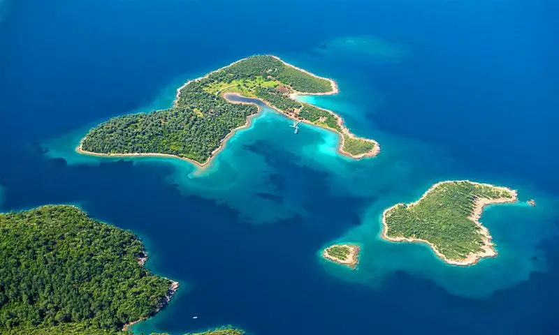
튀르키예 무글라
무글라는 시간이 멈춘 듯한 곳으로, 역사와 자연이 보존되어 있으며, 바다와 소나무 숲이 마치 산호초처럼 어우러져 있는 곳으로 유명합니다. 이곳은 에게해와 지중해 사이에 있는 좁은 지협에 위치해 있습니다.
남부 에게해 지역에 위치한 무글라는 아름다운 자연 경관, 따뜻한 날씨, 깨끗한 해변 덕분에 인기 있는 관광지입니다. 고대부터 현재에 이르기까지 이 도시의 풍부한 역사와 문화는 잘 보존되어 왔습니다.
동굴에 있는 암각화를 보면, 수많은 문명이 번성했던 지역인 무글라에 최초로 사람이 정착한 시기는 선사 시대로 거슬러 올라갑니다.
무글라에서 햇볕, 모래, 바다를 즐기는 동안 관광객들은 도시 곳곳에 있는 다양한 박물관과 고고학 유적지를 탐험하며 이 지역의 풍부한 역사를 배울 수도 있습니다.
무글라의 문화 센터
무글라 문화관(Mugla Kultur Evi)은 인기 있는 관광 명소이며, 전통적인 터키 건축 양식의 훌륭한 예시입니다. 1800년대에 지어진 이 문화관은 1999년에 국유화되었으며, 터키와 그리스 건축 양식을 한눈에 비교해 볼 수 있는 좋은 장소입니다.
무글라 박물관
Our museum features Archeology, Ethnography, Gladiator, and Natural History Halls spread out over two stories and arranged around an open courtyard. Items such as weaving looms and tool chests can be found in the ethnography section of the museum. The Stratonikeia ancient city donated seven gladiator grave steles to the Gladiators Hall, and the Archaeology Department displays fossils of plants and animals that are 9 million years old.
야즈칠라르 여관
1940년대부터 여행객들은 야즈칠라르 여관(Yagcilar Hani)에 머물렀습니다. 이 도시는 한때 번성했으며, 이 여관은 중요한 상업 중심지 역할을 했습니다. 이 여관의 안뜰에는 플라타너스 나무가 있어 그늘을 제공하며, 이 여관은 오래된 기름 공장(또는 야가네)을 개조하여 만들었습니다. 플라타너스 나무 아래에서 저희와 함께 차 한 잔을 마시며 여행 중 잠시 휴식을 취하세요.
사부르하네 광장
As a typical settlement, Saburhane Square (Saburhane Meydani) features a harmonious blend of the local Turkish and Greek (or Muslim and Christian) cultures, as well as a distinctive architectural character shaped by the surrounding landscape. The former prison gave the square its current moniker. Nearly one hundred streets, old inns, fountains, bazaars, squares, and mosques make Saburhane Square a model urban site. It also features nearly four hundred registered houses and nearly one hundred examples of civil architecture. When you get to a dead end, you can enter a courtyard with a gate and reach some homes. Mugla homes, like the homes in the surrounding region, are easily recognizable by their porches, patios, wooden decorations, verandas, and embedded closet-shaped bathrooms.
무글라의 굴뚝과 집들
Traditional Mugla homes are one of the city's most recognizable symbols, and they have been shaped in large part by the city's natural and cultural histories. Mugla homes can be roughly categorized as either Turkish or Greek. Mugla homes do not feature the haremlik and selamlik sections found in other types of traditional Turkish architecture. In Turkish homes, which typically have two stories, the floor that opens out to the garden is known as the "life" floor. In contrast, most Greek homes are two-story stone structures with clean exteriors. These homes are typically designed with storage areas on the ground floor and living quarters on the second story. There is no wall separating the homes that face the street or road, which is a clear indication of the merchant class's social standing.
다른 지역의 주택들과 달리, 무글라의 집들은 독특한 굴뚝으로 가장 쉽게 구별할 수 있습니다. 무글라의 굴뚝은 지역 기후의 영향을 많이 받습니다. 굴뚝 안으로 물이나 바람이 들어오는 것을 막기 위해 굴뚝 윗부분에는 덮개가 설치됩니다. 숙련된 석공들은 터키 스타일의 타일을 사용하여 통일된 디자인의 “무글라 굴뚝”(무글라 바차스)을 건설했는데, 이는 도시의 상징적인 건축물입니다.
역사적인 아라스타 바자르
무글라는 이즈미르-아이딘-치네, 타바스-데니즐리 노선을 통해서만 외부에서 접근할 수 있었기 때문에, 이 노선을 따라 이동하는 모든 상단은 도시를 지나가야 했습니다. 현재의 세키바시 거리에서 낙타 상단이 도시에 진입했고, 야즈칠라르 여관과 코차한 여관에서 머물렀습니다. 이 지역은 오늘날에도 여전히 도시 보호 구역의 상업 중심지입니다. 상단은 사부르하네 지역에서 출발하여 “일란흘 다으 요루(뱀산 길)”를 통해 타바스로 이동한 다음 데니즐리로 계속 이동했습니다. 야즈칠라르 여관, 이브라힘 여관, 바칠라르 여관, 발초글루 여관, 코나칼트 여관 등이 그 경로에 있었습니다. 코나칼티 하니와 코차한(현재는 존재하지 않음)은 도시 생활의 중심지였습니다. 이들은 고대 상업로의 한 구간에 위치해 있었습니다. 아라스타 바자르(차르시시)에는 다양한 전문 무역 협회, 즉 ‘조합’이 자리 잡고 있었으며, 각 조합은 특정 구역에 자신들의 이름을 붙여 구역을 표시했습니다.
데미르칠레르 아라스타스와 바크르칠라르 아라스타스는 오늘날에도 여전히 사용되고 있습니다. 아라스타 북쪽에 위치한 타바하네는 이 도시의 주요 상업 중심지 역할을 했습니다. 수많은 대상(商隊)이 이곳에 들러 현지에서 가공된 가죽을 확인했습니다. 손으로 작동하는 직조기에서 만든 직물, 목재 제품, 그리고 하무르수즈 산에서 채굴한 고품질 석회도 대상들에게 매우 귀중하게 여겨졌습니다. 역사적인 상업 중심지인 아라스타는 무글라를 통과하는 옛 대상 루트의 남북 및 동서 축이 만나는 지점에 위치하며, 이곳은 건축 역사가 풍부하고 상업적으로 발달한 지역입니다.
구무스케센 묘비밀라스 시의회는 저명한 시민과 그의 가족을 기리기 위해 이 웅장한 건축물을 건설하기로 결정했습니다. 이 인물은 통치자나 군사 지휘관이었을 수 있습니다. 밀라스 외곽에 있는 소드라 산(소드라 다으) 동쪽 기슭에 위치한 이 정착지는 한때 고대 도시의 네크로폴리스(묘지)가 있던 곳입니다. 지형의 경사로 인해 소드라 산에서 채취한 회색 줄무늬가 있는 대리석으로 만들어진 무덤 구조물이 평평한 플랫폼 위에 세워졌습니다. 지하층은 시신을 안치하는 장소로 사용되었고, 주층은 종교 의식에 사용되었으며 기둥으로 둘러싸여 있었으며, 상층은 기둥으로 지지되었습니다. 동일한 기둥들이 구조물의 세 가지 주요 부분을 구성했습니다.
지붕은 거대한 대리석 블록이 넘쳐나면서 안쪽으로 오그라들 때 만들어졌습니다. 그곳에 묻힌 사람이 얼마나 중요한 인물이었는지, 그리고 돌이 얼마나 정교하게 조각되었는지를 보여주기 위해 기하학적이고 꽃무늬 디자인으로 수를 놓았습니다.
This unusual and evocative architectural style is reminiscent of the Mausoleum of Halicarnassus, one of the New Seven Wonders of the World, and has parallels in the Eastern Mediterranean and North Mesopotamia (South East Anatolia). It was made in the middle of the second century, based on how it was built and how it was decorated with marble.
쿠르순루 모스크The Mentese Balibey District is home to the historic Kursunlu Mosque (Kursunlu Cami), which dates back to the Ottoman era. It was built in 1493 by Es Seyit Sucaaddin. Architect Serif Efendi constructed the narthex in the year 1900. A similar minaret was constructed by Haci Ismail around the same time. The large, lead-covered dome of this mosque, which was once home to a madrasah with thirty rooms, sets it apart from others in Mugla. The madder colors used to process the hand-carved decorations inside the mosque came from Rhodes. The main walls are crafted from Seljuk-style smooth-cut stone.
세이흐 모스크Construction began in 1565, and Sheikh Bedrettin is credited with its completion. The minaret was constructed at the beginning of the nineteenth century, during one of many restorations of the mosque. Among Mugla's oldest mosques, the Seyh Mosque (Seyh Cami) is steeped in tradition and significance. According to Evliya Celebi, who visited it in 1671, the Seyh Mosque in Mugla is a significant structure.
옐리 모스크이 모스크는 도시 성벽 동쪽에 위치한 케페즈 지역에 있습니다. 중앙 돔이 특징이며, 이 모스크의 현관은 엇갈린 아치형 천장으로 덮여 있습니다. 마름모 모양의 펜던티브가 돔을 지지합니다. 서쪽 파사드의 북서쪽 모서리에는 현관(지붕이 있는 복도)으로 이어지는 아치가 있으며, 현관은 타일로 장식된 벽으로 둘러싸여 있습니다. 또한 건물 동쪽에 있는 넓은 문을 통해 모스크 안으로 들어갈 수 있습니다.
석회암은 기둥, 문틀, 아치에 사용되었습니다. 모스크의 음향은 벽 안에 숨겨진 세라믹 큐브를 통해 제공되며, 이 큐브는 샹들리에 높이에 위치합니다. 주조 방식으로 만들어진 석고 큐브는 대부분 손상되었습니다. 이 작품은 1300년대에 제작되었습니다.
피루즈 베이 모스크피루즈 파샤 지구의 중심부에 위치한 이 건물은 1394년에 지어졌으며 넓은 안뜰의 중앙에 자리 잡고 있습니다. 모스크의 남쪽, 히사르바시와 옐데기르메니 사이에 위치한 중앙 구역은 마드라사 방들로 둘러싸여 있습니다. 모스크 돔의 납으로 덮인 지붕 때문에 “쿠르순루” 모스크로 알려져 있지만, 건물의 주요 벽은 녹색 대리석으로 만들어져 “고크” 모스크라는 다른 이름으로도 불립니다. 안뜰은 남쪽, 북쪽 또는 동쪽에서 접근할 수 있습니다. 초기 오스만 제국의 건축 양식에서 영감을 받은 이 건물은 거꾸로 된 “T”자 형태의 구조를 가지고 있습니다.
구체적으로 말하자면, 이곳은 무글라 주의 밀라스 지구에 위치하며, 바파 지구 경계 내에 있는 골랴카 마을(골랴카 쾨이)에 있습니다.
이 수도원은 주변의 다른 수도원들보다 규모가 커서 웅장하게 솟아 있습니다. 수도원의 동쪽에는 넓은 안뜰이 있고, 서쪽에는 더 작은 안뜰이 있는데, 두 안뜰 모두 바위로 둘러싸여 있습니다. 상부 성채는 벽으로 둘러싸여 있으며 작은 안뜰의 북쪽에 위치하고, 작은 대피소 성채는 남쪽의 바위 위에 세워져 있으며 사격공으로 보강되었습니다.
서남쪽 지역에는 종교적인 중심지가 있었을 것으로 추정됩니다. 일반적인 형태의 예배당 두 곳과 더불어, 내부가 파여진 반원형의 공간(앱스)이 있는 동굴이 있습니다. 예배당 서쪽 벽 앞에 있는 짧은 계단을 따라 내려가면 지하의 앞쪽 방으로 들어갈 수 있습니다.
일부 프레스코화에는 예수님의 삶, 사역, 죽음, 부활, 그리고 나사로의 장례, 예언자 예수의 십자가 처형, 빈 무덤, 부활 장면 등이 묘사되어 있습니다.
시계탑무글라의 초대 시장이었던 하지 카디자데 술레이만 에펜디와 그의 아내 펨베 아나는 1895년 다마스쿠스를 거쳐 메카로 가는 길에 이와 유사한 시계탑을 보았고, 자신들의 도시에도 하나 있으면 좋겠다고 생각했습니다. 이에 그들은 유명한 그리스 건축가들을 고용하여 현재의 시계탑을 건설하도록 했고, 이 시계탑은 미하일 콘스탄티누스의 아들인 필바루스가 설계했습니다.
민도스 고대 도시
뮈도스는 오늘날 구무슬루크로 더 널리 알려져 있으며, 고대 작가들이 언급한 도시 중 하나입니다. “카리아의 요람”으로 불리며, 마우솔로스 왕에 의해 건설되었습니다. 이곳에 가려면 그다지 많은 노력이 필요하지 않습니다. 현재는 일부 비잔틴 교회, 일부 도시 성벽, 언덕 위에 잘못 지어진 레레기안 성벽의 잔해, 그리고 부두와 탑 외에는 거의 아무것도 남아 있지 않습니다. 하지만 땅속에는 반쯤 묻힌 기둥, 모자이크 조각, 도자기 파편 등이 곳곳에서 발견됩니다. 알렉산드로스 대왕의 실패한 공성전 이후, 이 도시는 그림 같은 어촌으로 변모했습니다.
이곳은 고대부터 포도주를 생산해 온 지역 중 하나입니다. 예전에는 뮈ンド스 와인에 바닷물을 섞어 마시면 소화에 도움이 된다고 여겨졌습니다. 실제로 이러한 관행은 다른 고대 사회에서도 흔하게 나타났습니다. 과거 구무슬루크로 불렸던 현재의 뮈ンド스는 감귤류 과수원으로 유명합니다. 양탄자 직조는 이 지역 문화의 일부이지만, 규모는 비교적 작습니다.
구무슬루크 마을에서 멀지 않은 곳에 위치한 코윤바바 리조트는 과거 마우솔로스 시대에 채석장으로 사용되었습니다. 한 번 방문해 보시는 것을 추천합니다.
보드룸 고대 극장
이 건축물은 기원전 4세기에 건설되었으며, 웅장한 규모를 자랑합니다. 고대 도시 할리카르나소스의 북쪽 지역, 고크테페의 남쪽 경사면에 위치한 이곳은 ‘네크로폴리스’라고 불리는 묘지입니다. 로마 제국 시대 이전의 극장의 특징이 고스란히 남아 있습니다. 보드룸의 고전 시대 유적 중 유일하게 보존된 것은 고대 극장(안티크 티야트로)입니다. 경기 전에 디오니소스에게 제물을 바치던 제단과 일부 좌석 사이에 있는 구멍은 천막으로 사용되었을 가능성이 있으며, 극장의 흥미로운 요소 중 하나입니다. 각 좌석 사이의 간격이 40cm로 넓어 총 13,000명의 관객을 수용할 수 있습니다.
카디 칼레시 교회
카디 성당 교회(Kadi Kalesi Kilisesi)는 튼튼한 기초를 갖추고 있지만, 그럼에도 불구하고 현지인들이 자주 방문하는 곳은 아닙니다. 대부분의 건물은 헬레니즘 시대의 유적으로서 중요한 의미를 지닙니다. 이 건물들은 한때 보드룸에서 판사들이 모이는 장소로 사용되었습니다. 오스만 제국 시대에는 카디 성당 교회가 지역의 권력과 종교의 중심지 역할을 했습니다. 오스만 제국 시대에는 해군의 보급항으로 사용되었으며, 이후에는 인근의 코스 섬과 칼림노스 섬과의 무역의 주요 거점이었습니다.
보드룸 성
바로 이 섬, 당시에는 제피리온이라고 불렸지만 지금은 반도로 변한 곳에 도시가 세워졌습니다. 보드룸, Turkey, and its namesake castle were constructed. Rhodes was the home of the Knights of St. Jean, who constructed this structure in 1406. Bodrum Castle was built during the Knights Period and still maintains its original layout and character. In terms of St. John's Knights' architecture, the castle is the only surviving example. It is an unrivaled piece of history and one of the world's best-preserved medieval monuments. The castle was built with stones salvaged from the ruined Mausoleum, which was once considered one of the Seven Wonders of the Ancient World.
From the time the St. Jean knights left Bodrum in 1523 until the early 19th century, the Ottomans used the castle as a prison. The British and French bombarded it during World War I, causing damage.
보드룸 수중 고고학 박물관
보드룸 수중 고고학 박물관은 현재 보드룸 성 안에 위치해 있습니다. 전 세계에는 이 박물관 외에 단 한 곳의 수중 박물관만이 존재하며, 그곳 역시 터키에 있습니다. 보드룸 수중 고고학 박물관은 이 분야에서 가장 중요한 기관 중 하나입니다. 1995년에는 유럽 올해의 박물관 대회에서 “특별상”을 수상했습니다.
The Bodrum Underwater Archaeology Museum is home to the world's largest collection of amphorae from the Eastern Mediterranean. The museum features 14 separate displays. The museum also features displays devoted to the Yassiada and Serce Limani shipwrecks. The Serce Harbour Shipwrecks Glass Debris Hall exhibits three tons of glass, both broken and intact, salvaged from the world's oldest sunken shipwreck, which occurred in 1025. In addition, the largest collection of Islamic glass in the world can be seen here.
보드룸 고고학 박물관에서는 카리알리 공주 홀, 영국 탑, 동로마 시대 난파선, 터키식 목욕탕 전시관, 유리 난파선 홀, 독일 탑, 동전 및 보석 전시관, 유리 홀, 숨겨진 박물관 뱀 탑, 울루부룬 난파선, 지하 감옥, 사령관 탑, 텍타스 유리 난파선 등을 관람할 수 있습니다.
보드룸 수중 고고학 박물관에 소장된 암포라 컬렉션은 동종 컬렉션 중 가장 규모가 큽니다. “퀸 아일랜드” 전시실이 있는 발타 탑은 십자형 아치 바로 옆에 있습니다.
기념 묘지 박물관
할리카르나소스의 영묘(마우솔로스를 위해 지어진 무덤)는 가장 중요한 역사적 유적 중 하나입니다. 방문해야 할 장소 in Bodrum and is widely regarded as one of the Seven Wonders of the Ancient World. Construction began while Mausolus, a member of the Hekatomnos dynasty, who had been appointed by the Persians as Satrap of the Caria Region, was still alive (353 BCE), and it was completed by his wife and sister Artemisia after his death.
당시 가장 강력한 통치자였던 마우솔로스는 자신의 위대함이 영원히 지속되고 그의 이름이 기억되도록 하기 위해 이처럼 거대한 건축물을 짓도록 명령했을 가능성이 높습니다.
터키의 수필가이자 소설가인 체바트 사키르 카바아글라츨리는 ‘할리카르나소스의 어부’라는 별명으로도 잘 알려져 있으며, 그의 이름은 사실상 보드룸이라는 도시와 동의어라고 할 수 있습니다. 마우솔레움의 디자인에 대해 질문을 받았을 때, 그는 “그냥 한번 생각해 보세요!”라고 적었습니다. 기존의 관습을 버리고 새로운 시도를 하다니… 얼마나 답답했을까요! “이 문제에 대해 생각할 때마다, 제 안에서 탬버린 소리와 함께 웅장한 북소리가 울려 퍼집니다.”
The Mausoleum is the tallest structure on the list of the Seven Wonders of the World, standing at a height of 801 feet. This is equal to the height of a 20-story apartment building, or roughly 50 meters.
Historical accounts place the building's design credit with Pytheos, who is also credited with designing the Athena Temple in nearby Priene. According to Vitrivius, the greatest sculptors of the fourth century BCE toiled here. Bryaxis, one of the sculptors, was originally from Caria; he was responsible for the four-horse chariot statues of Mausolus and Artemisia that sit atop the Mausoleum.
Despite its longevity of 1500 years, the monument was destroyed by an earthquake in 1304. Among the Seven Wonders of the Modern World, the Mausoleum has endured.
스트라토니케아 유적
The ancient city of Stratoniceia was established in the third century BCE. Seleucus I of Syria had his son Antiochus marry his daughter-in-law, Stratonice. After marrying his stepmother, Stratonice, Antiochus named the city after her. Strabon, a famous travel writer, reported that the city was full of stunning architecture. Archaeological finds of coins date the city's transition from using Rhodes' currency to minting its own until the reign of Gallienus in 167 BCE (253-268 CE). The city's acropolis can be found atop the southernmost mountain. A wall encloses this hilltop. The Emperor's small temple stood on a terrace on the slope to the north, just below the modern highway.
라트무스에 있는 헤라클레아 유적
In Greek, we have the word "latmos." Due to the presence of the Mother Goddess Lada, this area was referred to by this name in the past. The ancient Greeks renamed the river Lada the river Latmus when they founded the city there. During the ten years that Pleistarchus of the Ptolemaic dynasty ruled the city at the turn of the third century BCE, the city on the coast of Latmus was known as Pleistarcheia; later, Lysimachus changed the name to Alexandreia. Neither of these names, however, stuck. Although the city's foundation date is unknown, it was mentioned in the 2nd-century BCE Battle of Miletos-Magnesia. When it finally broke away from Roman control, its status skyrocketed. Many churches and monasteries were established during its time as an episcopal center in the 7th and 9th centuries. The Hellenistic era was the height of glory for Heracleia on Latmus. Lysimachos extended the city walls in 287 BCE, and their total length increased to 6.5 kilometers.
Following the abandonment of Heracleia, the first half of the eighth century saw the construction of monasteries and churches. 170 examples of rock art show the change from the Paleolithic to the Neolithic.
카우노스 암벽 무덤
Even though it is now known as one of Turkey's most fascinating destinations thanks to its rock tombs, Kaunos was once a thriving port city, but the gradual accumulation of alluvium in the sea caused it to lose its strategic location. The city's acropolis, located on top of a 152-meter-tall hill, serves as its beating heart. Some of the city walls in the north date back to the Middle Ages. From its beginning on the northern side of the harbor, the long wall winds its way south, past Dalyan Village, and up the cliffs that lie beyond. In the time of Mausolus, the well-known Satrap of the Caria region, where Kaunos is located, the northern section of the wall was constructed. His tomb in Bodrum, Turkey, is one of the Seven Wonders of the World (Halicarnassos). The walls running northwesterly date to the Hellenistic Era (323 BCE–30 BCE), while those running southeasterly towards the harbor date to the Archaic Era (750–475 BCE). The ancient city's theater is located near the base of the Acropolis. Among the city's surviving structures, one belonged to a basilica-style church that stood to the west of the theater; the others were the foundations of a Roman bath and temple. From Dalyan, you can see rock tombs that have been used since the 4th century BCE and were later repurposed by the Romans. Giant fires were lit in the rock cavities visible from the pier, which guided ships carrying goods to Kaunos into the ancient harbor.
고대 크니도스서부 아나톨리아에서 가장 중요한 해안 도시 중 하나인 크니도스는 로도스 지역 단위에 속합니다. 에게해와 지중해가 만나는 다트차 반도의 가장 끝자락에 자리 잡은 테키르 곶이 바로 그곳입니다. 크니도스의 번성한 경제는 주로 와인 수출 덕분이었습니다. 이 도시는 군사용 항구와 상업용 항구 두 곳을 가지고 있었으며, 둥근 모양과 각진 모양의 탑이 세워진 성벽으로 둘러싸여 있었습니다. 도리스 신전, 아폴론 신전과 제단, 둥근 신전과 제단, 의회 건물, 코린트 신전, 계절과 시간을 나타내는 해시계, 극장, 디오니소스 신전과 경사면 주택, 오데온 등이 있었습니다. 데메테르의 신성한 장소, 네크로폴리스, 그리고 크리오 반도는 모두 이 고고학 유적지에 있는 중요한 건물과 지역입니다. 영국의 고고학자 찰스 뉴턴은 1858년 크니도스에서 발굴 작업을 하면서 일기에 이렇게 적었습니다. “헬리오스가 있는 작은 도시 크니도스에는 그가 자랑스러워할 수 있는 아프로디테 동상이 있습니다. 이 동상은 비티니아( 에게 해 지역 북쪽)의 왕 니코메데스가 모든 수입을 보여주는 동상입니다.” 프락시텔레스가 크니도스를 위해 만든 옷을 입지 않은 아프로디테 동상의 받침대는 여전히 그 자리에 있지만, 동상 자체는 시간이 지나면서 사라졌습니다.
틀로스 고대 도시
Tilos joined the Lycian Union around the second century BCE. Tlos, was one of the few ruins to survive into the 9th century because it continued to operate during the Byzantine period. Transportation was arranged along the Fethiye-Korkuteli highway through the Kemer neighborhood, 13 kilometers past the Yaka village castle quarter. There is evidence that Lycian urban centers have been inhabited since the 5th century BCE. Nothing before the 2nd century B.C.E. has been found, so we don't know exactly when these cities were founded, but life in Lycia begins. An axe that was discovered by chance in Tlos also lends credence to this argument. It is believed that Tlos, then known as Talaw, existed in the second century.
헤카톰노스의 영묘
카리아 지역의 남서부 아나톨리아에 위치한 중요한 도시 중 하나인 무글라에는 헤카톰노스 영묘와 성역(헤카톰노스 기념 묘지와 성스러운 장소)이 있습니다. 테메노스 벽, 메난드로스의 명예 기둥, 성역의 단, 그리고 영묘 자체가 앞서 언급한 기념 단지를 구성합니다(보관실, 묘실, 석관, 그리고 드로모스). 이 기념물들은 여러 가지 이유로 특별합니다. 첫째, 현재까지 남아 있는 유일한 종류의 건축물이며, 둘째, 할리카르나소스 영묘보다 더 오래된 시대로 거슬러 올라가고, 셋째, 마우솔로스의 아버지의 기념물이며, 넷째, 할리카르나소스 영묘와 동일한 크기를 가지고 있습니다. 이 건축물은 뛰어난 품질을 자랑합니다. 건축과 조각, 벽화와 같은 다른 중요한 예술 형태를 포함하여, 이 유적은 고대 세계에서 가장 중요한 무덤 기념물이며, 죽은 자를 숭배하는 종교의 상징이 됩니다. 특히 주목할 만한 점은 "프레스코화가 그려진 석관"이 고전 시대와 헬레니즘 시대의 아나톨리아에서 유일하게 알려진 사례이며, 특히 중요한 인물을 위해 제작되었다는 것입니다.
잔토스와 레토온의 고대 유적지 (유네스코 세계문화유산)
Xanthos is found within Antalya province, 46 kilometers from Fethiye, and close to the village of Kinik. Before falling under Persian rule in 545 BCE, it served as the de facto capital of ancient Lycia. About a century after that, it was destroyed by fire. The city was destroyed, but it was rebuilt and became the Lycian Union's capital in the second century BCE. The city was subsequently conquered by the Romans, then by the Byzantines, and remained under Byzantine control until the Arab invasions of the 7th century. As a cultural hub that shows the influence of Lycian, Hellenistic, and Roman cultures, as well as those that came before and after, this location was added to the UNESCO World Heritage List in 1988.
현재의 무글라 주에 위치하며 잔토스에서 불과 4km 떨어진 곳에 있는 레토온은 고대 리키아의 종교 중심지 역할을 했습니다. 이 신성한 장소에는 레토, 아폴로, 아르테미스 신전과 더불어 수도원, 분수, 로마 극장의 유적이 남아 있습니다. 아르테미스와 아폴로의 어머니에게 헌정된 레토 신전은 도시 서쪽 지역에서 가장 큰 규모를 자랑합니다. 페리프테로스 양식으로 설계된 이 건축물은 가로 30.25m, 세로 15.75m의 크기입니다. 동쪽에 위치한 아폴로 신전 역시 도리아 양식으로 지어졌지만, 레토 신전만큼 잘 보존되지는 않았으며 크기는 가로 27.90m, 세로 15.07m입니다. 아르테미스 신전은 이 세 신전 중 가장 작습니다. 두 번째 유적은 지리적으로 중심에 위치하며, 크기는 18.20m x 8.70m입니다. 레툰과 잔토스는 유네스코 세계문화유산 목록에 등재된 많은 유적 중 두 곳입니다.
세디르 섬
세디르 섬(Sedir Adasi)에는 높이가 0~15미터로 추정되는 유적이 있으며, 이 섬에서 발견할 수 있습니다. 무글라 주의 울라 지구, 아캬카 지구, 마르마리스 지구의 캄흘리 마을에서 매일 배가 출발하여 관광객들을 이 지역으로 데려다줍니다.
이 섬은 한때 케드레아이 공동체의 고향이었으며, 케라모스 만에 위치해 있습니다. 과거에는 터키 시대에 세히로글루라고 불렸지만, 현재는 세디르 섬으로 알려져 있습니다. 한때 이 섬에 삼나무가 무성했을 수도 있지만, 현재 세디르 섬에는 삼나무가 없습니다.
이 삼각형 모양의 섬과 인근의 오라타 섬, 쿠чук 아다 섬은 해안선 길이가 800미터입니다. 세디르 섬을 둘로 나누는 지협의 동쪽은 사람들이 처음 정착한 곳입니다. 이 지역은 벽으로 둘러싸여 있으며, 도시의 극장, 종교 시설, 왕궁, 항구 및 기타 중요한 공공 및 종교 시설을 포함하고 있습니다. 육지의 항구 및 기타 공공 시설의 일부인 네크로폴리스는 동쪽에 위치해 있습니다.
고대에는 로도스가 해당 지역의 모든 토지를 소유하고 있었으며, 그중에는 세디르 섬도 포함되어 있었습니다. 역사적으로 로도스는 로도스 반도의 일부인 보즈부룬 반도에 대해 가장 강력한 영향력과 지배력을 행사했습니다. 이 도시에는 아폴론 신전, 대성당, 키스타크 교회, 아고라가 있으며, 2,500명을 수용할 수 있는 극장도 있습니다.
이디마
ocated in the northeast corner of the Gulf of Gokova, the town of Akyaka is home to the 2,500-year-old city of Idyma. The ruins of Idyma's city can be seen today from Gokova village to the base of Kran Mountain (Kiran Dagi). Remains of the city's acropolis (upper city), dating back to the fourth and third centuries BCE, can be found on the hill rising just to the north of Gokova village. One can visit a necropolis (cemetery) that has seen tragedy on the hill's eastern slope. The tombs, carved out of the rocks that lined the hillside, were constructed in the style of homes so that the dead could keep living after death. Some of the rock tombs were built in a more lavish fashion than others, mirroring the design of temples found in many of Anatolia's ancient cities. This was done to highlight the disparities in wealth at the time. Located between Akyaka and the village of Gokova, Nisdibi is home to a monumental rock tomb that is the best-preserved of its kind. The Byzantine fortress of Azmak, located on a nearby hill, can be seen from this very road.
아민타스의 암굴 무덤페티예에는 가파른 바위 경사면에 파서 만든 많은 암벽 무덤이 있는데, 그중 세 곳은 신전이고, 나머지는 뛰어난 토목 기술을 보여줍니다. 세 가지 신전 중 하나인 “왕의 무덤”은 다른 두 곳에 비해 비교적 온전한 모습으로 남아 있습니다. 이 이오니아 양식의 전주식 신전(전면에 두 개의 기둥이 있는 신전 형태)은 바위 위에 지어진 신전의 정면을 나타내는 것으로, 동쪽 전면 벽의 중앙 부분에 새겨진 “헤르마피아스의 아들 아민타스”라는 비문 때문에 아민타스 무덤이라고 불리며, 기원전 4세기로 추정됩니다. 이 도시의 상징인 다른 무덤들은 같은 가파른 경사면의 동쪽에 위치하며, 그중에서도 가장 뛰어난 무덤입니다. 리키아 지역의 금속 공예와 목공 기술에 대한 정보를 제공하는 예시들입니다.
무덤으로 이어지는 벽면에는 네 개의 주요 패널로 구성된 문이 그려져 있습니다. 방 안쪽에는 세 줄의 선과 매끄러움과 거칠음이 번갈아 나타나는 천장이 있습니다.
18세기와 19세기에는 많은 사람들이 텔메소스 고대 도시(텔메소스 고대 유적)와 그 근처에 있는 암벽 무덤을 방문했습니다.
카야쾨이
Located just 8 kilometers (km) south of Fethiye, the village of Kayakoy was formerly known as Karmilissos. Philological evidence suggests that the village was established in the third century BCE; however, no artifacts older than the fourth century BCE have been uncovered. All of the clusters of buildings on the town's hillside were constructed by Greeks who moved there in the second half of the nineteenth century and the first quarter of the twentieth century, taking advantage of protections afforded to minorities by the Ottoman Empire. Since the population exchange between Greece and Turkey, the town has been abandoned. Due to natural factors, the village looks like a ghost town because the wooden doors, windows, and exteriors of the houses have decayed. Before the town was deserted, its estimated 350–400 homes were constructed so as not to interfere with one another in terms of sightlines and lighting. The total floor area of these 50-square-meter buildings was split between two stories. Cellars were typically located on the ground level. Rainwater was collected from roofs and stored in underground cisterns adjacent to the front door of each home. There are many chapels interspersed among the homes, as well as two large churches, a school, and a customs office.
이즈투주 해변에 서식하는 바다거북, 특히 붉은머리바다거북(Caretta caretta) 해변
이즈투주 해변은 지구상에서 붉은바다거북을 볼 수 있는 마지막 장소 중 하나일 뿐만 아니라, 자연 그대로의 모습을 간직한 세계에서 두 번째 해변이기도 합니다. 이즈투주 해변에 서식하는 온순한 붉은바다거북은 키가 1~1.5m 정도이고 몸무게는 약 150kg입니다. 이 사랑스러운 생물들은 해안으로 헤엄쳐 와서 뒷다리를 사용하여 알을 낳을 구멍을 파냅니다. 어두워지면 새끼 거북들은 본능에 따라 달빛을 따라 바다로 향합니다. 하지만 물까지 가는 데 시간이 걸리기 때문에 쉽지 않은 여정입니다. 햇빛이 나올 때까지 계속 움직여야 합니다. 태양이 떠오르면 온도가 조금 올라갑니다. 햇빛과 새로부터 자신을 보호하지 못하는 개체는 죽습니다. 바다에 도달한 후에도 여전히 위험이 존재합니다. 특정 크기에 도달할 때까지는 물고기의 먹이가 될 운명입니다. 본능에 따라, 성체가 되어 거대한 크기로 자란 극소수의 개체만이 결국 태어난 해변으로 돌아갑니다.
산란기에는 이 해변에서 불을 피우거나 조명을 사용하는 것이 금지됩니다. 이는 어린 새끼들이 혼란을 느끼고 바다에서 멀어지게 할 수 있기 때문입니다. 해변에는 영구적인 구조물을 설치할 수 없으며, 알은 안전한 환경에서 수집됩니다. 전 세계의 환경 보호론자들이 산란기에 해변에 모여 캠프를 설치하고, 때로는 해안을 향해 행진하는 시위를 벌이기도 합니다.
고대 교역로를 찾아서
무글라는 일반적인 해변 휴가 외에도 다양한 종류의 관광 상품을 개발할 잠재력이 큽니다. 트레킹은 인기 있는 대안적인 관광 형태이며, 리키아의 길(Likya Yolu), 카리아의 길(Karia Yolu), 카누니 트레일(Kanuni Yolu)과 같이 많은 유명한 트레킹 코스가 조성되어 있습니다.
세계에서 가장 훌륭한 장거리 도보 여행 코스 10곳 중 하나인 리키아의 길은 총 540킬로미터에 달하며, 그 경로를 따라 19개의 고대 도시를 연결합니다.
수천 년 동안 유목민들이 이용해 온 리키아의 길은 페티예에서 시작하여 안탈리아까지 이어집니다. 리키아의 길을 따라 여행하는 사람들은 해안과 산맥 사이를 이동하면서 로마 시대의 도로, 고대 길, 그리고 당나귀가 다니던 길 등 다양한 길을 만나게 될 것입니다. 카바크 만(카바크 코유)과 천국의 만(천넷 코유)과 같은 자연 경관과 안티펠로스, 스디마, 레툰, 리미라, 시메나, 잔토스, 파타라, 아폴로니아, 키메라, 미라, 올림포스, 파셀리스와 같은 역사 유적지, 그리고 여정 중에 머물 수 있는 마을, 숙박 시설, 또는 텐트 등이 있습니다.